Why are there haystacks in the middle of the Buffalo River?

(Ian admits the sound in the video above is terrible, but what I am saying is we are starting a 30-mile float trip on the Buffalo River in Arkansas and the bridge behind me was underwater in the 1982 flood.)

The guidebook describes the Clabber Creek Shoal as the “wildest rapids of the lower river.”

That’s a lie.

It’s the wildest rapid on all 135 miles of the Buffalo River in Arkansas, from Ponca down to the White River. I know because after my third trip there recently, I have floated all those miles over all those rapids.

The book “Buffalo River Handbook” by Kenneth L. Smith, talks about Clabber Creek Shoal current going right, then left, don’t get swept into the right bank and don’t get swamped by the haystacks.

Haystacks? Odd thing to have in the river.

Since then I have learned that “haystack” waves are not like the riffles, wave trains and strainers and stags I had glided happily over or have avoided on previous trips on the Buffalo. Haystacks don’t move downstream as you do; they stay right there where some underwater rock – or rocks – put them.

I, in my ignorance and hubris, figured I’d have no problem. Even a 275-prop will come down if you aim your tackle low enough.

No problem avoiding the right bank. On to the haystack waves, bow first and over the top as I always once did. I got up and over one. Sloughed through another and looked into the base of a Cecil B. DeMille wave. Sometimes the prop runs over you, and the Red Sea wave wins no matter where you aim your attack.

It flicked my kayak over to the left, and I remembered two things as the kayak turned: Stay with the boat and don’t lose your paddle. Fortunately, all my belongings were well attached. Dry bags, water jugs and carabiners all held to my new shock cords. My hatch cover leaked some, but tent, sleeping bag, camp chairs and coats (a bit damp) all stayed aboard.

The only things dumped into the river were unattached: the map case, my Stanley coffee thermos and me.

I pulled myself up over the overturned boat with my paddle in hand and peeked over the hull to see my thermos headed for the goal line. Kicking for shore with two legs and one arm as down the river we went.

Ian, my partner, took his kayak to the left of the haystacks, stayed upright and then did things in the right order. First getting the map case, then the thermos and finally towing me and kayak the last few yards to shore.

DCIM100GOPRO
Mostly wet and checking my fogged binoculars. Photo by Ian Gunn

The underwater camera seems to be working fine, but looking through the binoculars (in the pocket of my life vest, which I was wearing) is like examining a one-celled animal swishing around on a fogged microscope slide.

Up until then, the trip had gone swimmingly. We launched at Dillard Ferry, upstream from Buffalo Point, and got to what we thought would be our first night’s camping spot at noon. So we decided to push on to the second night camp spot. We needed the rescued maps and Ian’s GPS to try to find it, and never did. But it’s hard to get lost when the river is pushing you downstream.

First camp
First night’s campsite.

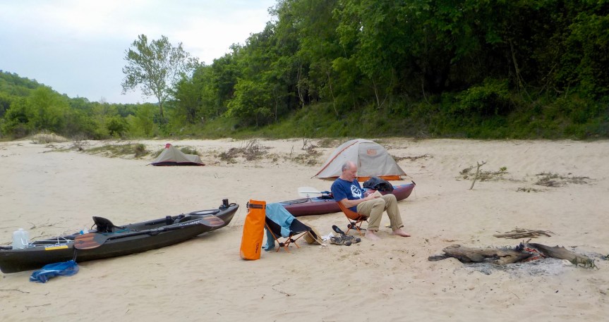
We found a great campsite but unfortunately followed some awful campers. Fire still smoldering, cigarette butts everywhere, soap and other trash strewn around and the TP flowers nearby with their white and brown blossoms.

Rekindled the fire, dried out clothes in sun, cooked, ate, read and to bed in skivvies – although the long johns are nearby.

Also see “Clobbered at Clabber Creek

DCIM100GOPRO
Cruising by Painted Bluff. Photo by Ian Gunn.
DCIM100GOPRO
Not a haystack wave in sight. Photo by Ian Gunn.


Canoeing: You can get wet – or worse

Canoe on bank
The Winchester Wasteway earlier this month.

An earlier post here told about a canoe trip on the Winchester Wasteway taken by Officer John and Editor John. That served as a practice run for Officer John to take his friend Keith on a return trip to Central Washington’s Wasteway this Memorial Day.

His quick summary of the latest trip: 99 percent perfect.

So what about the other one percent? Here’s his report:

“I paddled the Winchester Wasteway Saturday for the second time in 17 days, this time with my friend Keith, who has a canoeing merit badge.

“We made the trip with a different attitude. When Officer John & Editor John made the trip, we had the attitude that we were to paddle fast — fast enough to make the trip in less than the oft-reported 12 hours. So we paddled fast and did the trip in about five hours paddling time.

“Armed with this experience, Officer John lectured Keith on the attitude of speed: Don’t. Paddle easily. Let’s take our time. Relax and enjoy the scenery. When possible, let the current do the work. Take advantage of the current to rest those tired arms.

“So we paddled for two hours and rested for 30 minutes. Then we paddled for two hours and rested for 30 minutes. Then we paddled for an hour and a half and got within 75 yards of the take-out at the end of road C.

“Remember now, we were taking it slow and easy the entire route.

“Seventy-five yards from the take-out, the current bumped the canoe against the right bank. The canoe flipped over and tossed us into at least three feet of water. We struggled to our feet and stood up just in time to watch our belongings float downstream.

“With tremendous difficulty we were able to walk the canoe past rocks and protruding tree roots to the take-out and, finally, to safety.

“We were not pleased with this clamorous end to an otherwise perfect paddle trip, which Keith estimated with some electronic authority to be 15 to16 miles.”

John and Keith want to remind us all that no matter what the paddle rating is, no matter how placid the situation seems, be careful out there.

They got wet, but their story prompted me to check on an incident where something worse happened. I mentioned that incident in a post on this year’s trip to the Buffalo River in Arkansas. On the day that Kathy and I were supposed to put in, the river at Buffalo Point was at 22 feet – the National Parks System closes the river to paddlers when it is at 10 feet.

Unfortunately for four canoeists farther upstream, they were already camped along the rising river. They tried to paddle out. Some of the four canoes flipped. Three paddlers made it to safety, but one did not. The body of Rick Norber, 65, from St. Louis, was found four miles downstream from where he was last seen. Condolences to his family.

This past week, I joined four others to take a canoe class. I paddled my first canoe more than 50 years ago at Boy Scout camp. Despite my canoe partner Bill Shockey (RIP) and I being ordered off the water for splashing others in the class, I also earned a canoeing merit badge. I have been taking regular water trips these past three years. But the class this past week taught me some new techniques and served as another reminder of how to stay safe and what to do to keep from going from wet to worse.

Disappointed, but safe, off the Buffalo

When the level of Arkansas’ Buffalo River hits six feet at Buffalo Point, the National Park Service restricts access to experienced paddlers. When it’s at 10 feet, the river is closed.

On Wednesday morning, when we were to start our four-day canoe trip from Buffalo Point to the confluence with the White River, the level was 16 feet.

On Thursday, it was 22 feet.

“We blew that one right out of the water, so to speak,” said the lady at the counter of our canoe rental office.

We never got on the river, and we are now dodging continued rain, possible flash flooding and wind and thunder storms as we head north to Kansas City.

Disappointed, but the power and danger of the river was brought home when we learned on Thursday morning that a canoeist on Wednesday had gone missing upstream of us.

Rockhouse
Inside the Indian Rockhouse at Buffalo Point

Kept off the river, we turned our attention to other pursuits. We walked the Indian Rockhouse Trail in the Buffalo Point State Park and then drove over to the Blanchard Springs Caverns for a tour.

We hope to be in Independence, MO, tonight for a visit to the Harry S. Truman Presidential Library and Museum.

And we are starting to point toward Seattle and home.

Cave
Inside the Blanchard Springs Cavern.